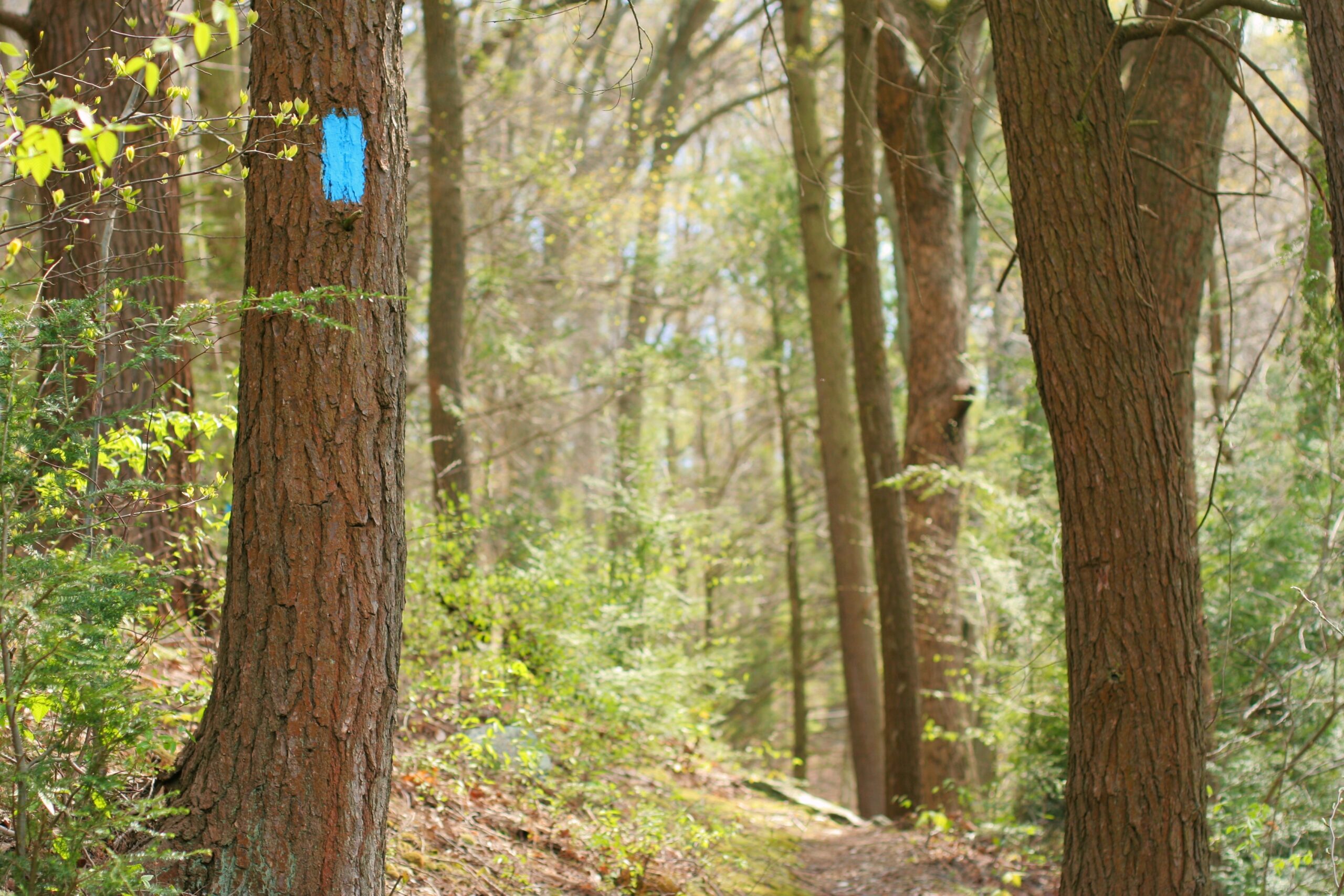
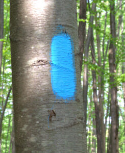
You’ll be seeing a lot of blue…
Our blazes are Sky Blue and can be easily spotted from a distance. Depending on the location, you may see them as plastic blazes or round emblems.
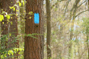
Because we are a system of trails, we often share our path with another trail belonging to a local, county or state park. This means that you may see another color next to ours, such as Red in the Broad Creek area of Maryland. In other places our trail passes through State Game Lands or private property. We appreciate that hikers who visit our trail system have a passion to help us keep the trails beautiful and litter-free.
What’s happening around the trail?
Latest news from our volunteers:
-
Post with a feature image
Pretty cool right? It’s not much but it’s one of the days out on the trail. After a series of storms the crew had quite… (read more)
-
New year, new website 🎉
This is an example of what one of our blog posts is going to look like. It’s very exciting. Hopefully we’ll see weekly posts coming… (read more)
-
Hello world!
Welcome to WordPress. This is your first post. Edit or delete it, then start writing! (read more)
Mapping
The 200 miles worth of Mason-Dixon Trail is split across 10 maps from West to East:
- Map 1 – Appalachian Trail at Whiskey Spring, PA to Pinchot State Park, PA
- Map 2 – Pinchot Park at Squire Gratz Road, PA to Wago Junction at the Susquehanna River, PA
- Map 3 – Wago Junction at the Susquehanna River, PA to Trinity Church Road South of Wrightsville, PA
- Map 4 – Trinity Church Road South of Wrightsville, PA to Otter Creek Campground, PA
- Map 5 – Otter Creek Campground, PA to PA – MD State Line
- Map 6 – MD State Line to Quarry Road North of Havre de Grace, MD
- Map 7 – Havre de Grace, MD to North East, MD
- Map 8 – North East, MD to Pleasant Valley Road, DE
- Map 9 – Pleasant Valley Road, DE to White Clay Creek Preserve at London Tract Road, DE
- Map 10 – White Clay Creek Preserve at London Tract Road, DE to Chadds Ford, PA
How to purchase maps
Physical Maps
Our water-proof paper map set made up of 10 maps can be obtained in a few different ways:
- They can be purchased in our online store.
- They are included as part of your membership fee for all new members – Join as a new member today!
- Lastly, they can be found for purchase at these physical locations:
- Shank’s Mare, 2092 Long Level Road, Wrightsville, PA 17368
- Susquehanna Gateway Heritage Area, 1706 Long Level Road, Wrightsville, PA 17368
Digital Maps
Here you can download official Geo-Referenced Maps of the Mason-Dixon Trail. Each map only costs $1.99 to download (we also have a few short hikes available for download at no cost). Proceeds from the sales of these digital maps goes towards maintaining and improving the 200 mile Mason-Dixon Trail in PA, MD and DE. Many volunteer hours were dedicated to creating these maps and keeping them up-to-date.
Currently only Maps 4 and 5 are available so far. We will eventually have all maps available digitally, keep checking back for updates.

You must use Avenza Maps to use our digital maps.
Scan this QR code to download the app.
Stay updated on your maps
There are currently 3 publications of our map set: 2012, 2016, and 2020. The trail can change before a new map set gets published so be sure to keep yourself informed with map updates provided by the M-DTS crew.
Become a Member!
When you become a member, you are provided a set of 10 highly detailed contour maps in a water-proof pouch. You can purchase our maps at certain locations as well as online directly from us. We also provide free updates and changes to our maps which are available here on this website.
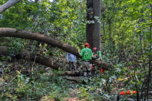
Keep the trail alive
The members of the Mason-Dixon Trail System, Inc. hope that you enjoy your hikes on the trail. Volunteers from several states have constructed and are maintaining it. Our organization is aging and needs to mentor a new generation to run the organization. Unless we get some new active members we are in danger of losing the trail. Please consider helping. We need officers in the organization as well as trail maintainers. We meet four times a year at the convenience of the officers. If you’d like to participate in any capacity please get in touch!