(formerly “Trail Status, Closures, and Relocations”)
Last Updated 3-20-2024
The MDTS publishes physical map updates roughly every 4 years. A lot can change in 4 years such as closures, temporary relocations, or permanent relocations so in order to make sure you stay on trail, we also publish updates here to our website.
All updates listed here are based on the 2020 map set.
If you are using a 2012 or 2016 map set, please note that the trail has since changed. We highly recommend that you upgrade to the latest map set (2020) to use our trail safely. Be sure to follow the trail as blazed if you continue to use outdated maps – our trail maintenance crews keep our blazes fresh.
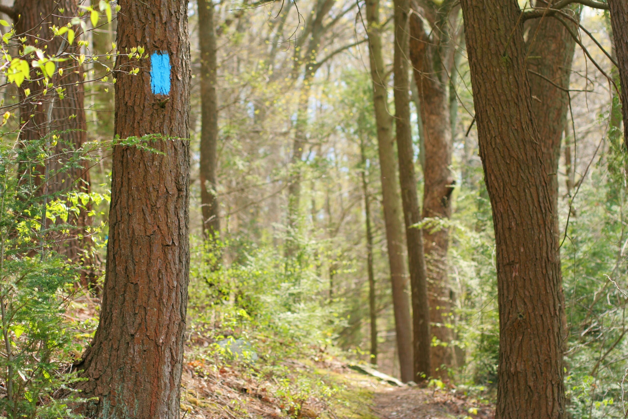
The following information represents the current trail status along the Mason-Dixon Trail as reported by users and posted by our maintainers.
The reference mile markers given are from the M-DT 2020 Map Set.
- Appalachian Trail at Whiskey Spring, PA to Pinchot State Park, PA
- Pinchot Park at Squire Gratz Road, PA to Wago Junction at the Susquehanna River, PA
- Wago Junction at the Susquehanna River, PA to Trinity Church Road South of Wrightsville
- Trinity Church Road South of Wrightsville, PA to Otter Creek Campground, PA
- Otter Creek Campground, PA to PA – MD State Line
- PA – MD State Line to Quarry Road North of Havre de Grace, MD
- Havre de Grace, MD to North East, MD
- North East, MD to Pleasant Valley Road, DE
- Pleasant Valley Road, DE to White Clay Creek Preserve at London Tract Road, DE
- White Clay Creek Preserve at London Tract Road, DE to Chadds Ford, PA
Map 1
Appalachian Trail at Whiskey Spring, PA to Pinchot State Park, PA
No Issues or Closures Reported
Map 2
Pinchot Park at Squire Gratz Road, PA to Wago Junction at the Susquehanna River, PA
- Susquehanna Trail misidentified: PA-295 should be PA-297
Map 3
Wago Junction at the Susquehanna River, PA to Trinity Church Road South of Wrightsville
- M-DT reroute through Hellam Hills adds 3.5 mi and viewpoints.
- M-DT open to hikers around the gate at Grace Plateau just West of Highpoint Scenic Vista.
Map 4
Trinity Church Road South of Wrightsville, PA to Otter Creek Campground, PA
- The M-DT along Otter Creek between Kline Rd & Otter Creek Campground has difficult footing in spots
Map 5
Otter Creek Campground, PA to PA – MD State Line
- Annual Trail Closure and Detour between SGL83 and Bare RD, PA
- MUST Call Peach Bottom Nuclear Power Plant Security before hiking the M-DT between Lay & Burk Roads
Map 6
PA – MD State Line to Quarry Road North of Havre de Grace, MD
- Glen Cove Marina footbridge has been re-built and is now open.
- Fisherman’s Park below Conowingo Dam NOW OPEN.
- M-DT rerouted between Lapidum Rd to Graceview Dr near Vulcan Quarry.
Map 7
Havre de Grace, MD to North East, MD
- M-DT is now OPEN through Perryville Veterans Administration Medical Center.
- M-DT rerouted along Razor Strap Road between Red Toad and US Rt. 40.
Map 8
North East, MD to Pleasant Valley Road, DE
- M-DT section is CLOSED along the power line clearance between Rosetree Lane (just east of the Delaware-Maryland State Line east of Elkton, Maryland) and Pleasant Valley Road (southwest of Newark, Delaware). A preliminary new re-route has been mapped that follows area streets
Map 9
Pleasant Valley Road, DE to White Clay Creek Preserve at London Tract Road, DE
- Annual Trail Closure within White Clay Creek State Park, DE for hunting season.
- Delancy Road, MD to White Clay Creek Park at London Tract Road, DE
- Susquehanna State Park to Quarry Road
Map 10
White Clay Creek Preserve at London Tract Road, DE to Chadds Ford, PA
- M-DT detoured onto roads around State Line Woods.
- Annual Trail Closure Along Cossart RD, PA during December and January